


test trail

brendan
User
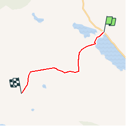

Length
5.9 km

Max alt
805 m

Uphill gradient
862 m
Km-Effort
14.8 km

Min alt
30 m

Downhill gradient
96 m
Boucle
No
Creation date :
2014-12-10 00:00:00.0
Updated on :
2014-12-10 00:00:00.0
3h16
Difficulty : Medium

FREE GPS app for hiking
 SityTrail
IGN / Geographical institutes
SityTrail Plus
The world is yours!
About
Trail Walking of 5.9 km to be discovered at Unknown, County Mayo, Westport-Belmullet Municipal District. This trail is proposed by brendan.
Positioning
Country:
Ireland
Region :
Unknown
Department/Province :
County Mayo
Municipality :
Westport-Belmullet Municipal District
Location:
Kilgeever ED
Start:(Dec)
Start:(UTM)
448901 ; 5946241 (29U) N.
Comments